GRANT is based upon a generic and flexible implementation of the optimal estimation inversion technique for atmospheric retrievals (OPT). Its adaptable architecture provides complete flexibility in defining user-configurable forward and sensor models to drive the optimal estimation routine.
The result is a software tool that is easily tailored to a specific sensor and measurement system. It can be used to generate high-fidelity simulated data for testing retrieval algorithm performance and characterizing the resulting data products. Retrieval characterization includes a detailed error analysis package as well as critical diagnostics related to information content, resolution, and model bias.
Beyond the analysis of existing remote sensing data sets, this tool also provides a powerful capability for rigorously evaluating design decisions on all aspects of future mission development, including sensor design, orbital/flight parameters, and measurement strategies (e.g., viewing geometry, cadence, spectral and spatial sampling).
GRANT is applicable to a wide range of remote sensing missions. It is currently being used in the operational data processing chain for two high-profile NASA science missions. On the MAVEN Mars mission, it is being used to retrieve density profiles of dominant constituents of the Martian atmosphere from analysis of limb radiance profiles measured by the IUVS instrument. In this implementation, the forward model used is CPI’s state-of-the-art FUV-NIR atmospheric radiance model AURIC, as adapted to Mars.
On the NASA GOLD mission, an FUV imaging spectrograph launched in January 2018, versions of GRANT and OPT are being used to retrieve exospheric temperature on the limb, effective thermospheric temperature on the disk and thermospheric O2 density profiles from stellar occultation measurements.
Past satellite remote sensing missions for which the GRANT or OPT tools have been used for operational data processing include: POAM II/III (stratospheric trace gasses and aerosols from solar occultation), UARS/SUSIM (thermospheric O2 density from solar occultation), SORCE/SOLSTICE (thermospheric O2 density from stellar occultation), and Coriolis/Windsat (ocean surface wind vector from microwave radiometry).
satellite remote sensing
For over 30 years CPI has provided critical scientific and technical support for many successful atmospheric remote sensing programs, applying our in-house expertise in the key areas of algorithm development, data processing and analysis and product validation. CPI also has complimentary capabilities for develoment of very sensitive, miniature photometers for use in small satellites and multi-spectral/hyper-spectral imaging applications.
CPI's research and development in the remote sensing field has been distilled into a set of core capabilities and software tools that support the entire mission life cycle: sensor and mission architecture design; design and development of ground data processing systems; algorithm development and implementation; data product development; operational data processing; and science data analysis, validation, archival and distribution.
CPI has developed a new class of sensors specifically optimized for CubeSat missions. The CubeSat Hyperspectral Imager (C-HSI) acquires high-resolution imagery in simultaneous spatial and spectral dimensions. Our space-based UV photometers measure airglow from naturally occurring ionospheric recombination without the need for special geometries.
Models
AURIC
The Atmospheric Ultraviolet Radiance Integrated Code (AURIC) is a software package originally developed by Computational Physics, Inc. (CPI) for the Air Force Phillips Laboratory (currently the Air Force Research Laboratory [AFRL]) for upper atmospheric radiance modeling from the far ultraviolet to the near infrared.
For more Details see Radiative Transfer Solutions⟶
Ground System Support
GRANT
CPI's Generalized geophysical Retrieval & ANalysis Tool (GRANT) facilitates analysis of remote sensing data from both terrestrial and planetary atmospheres.
More information
Instruments
UV Photometer
For more Details see Presentation on UV Photometer⟶
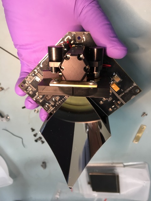
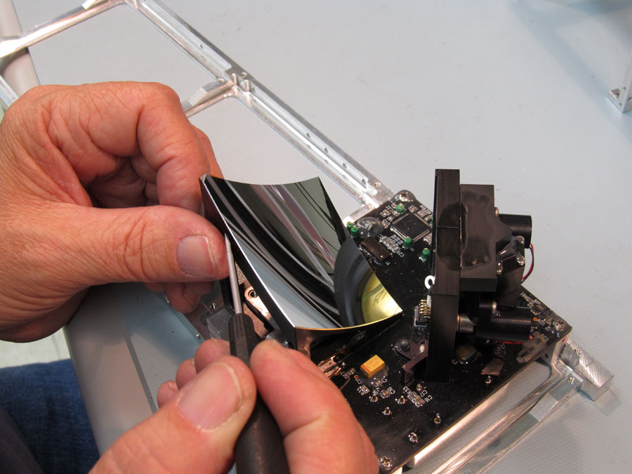


Space Telescope
More information
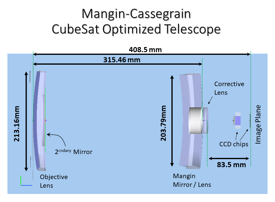
- Fully scaleable optical design
- Current design dimensions: 410 mm x 215 mm x 215 mm
- Entrance pupil aperture: 213.2 mm
- Obscuration: 55%
- Effective focal length: 810 mm
- Working F/#: 3.8
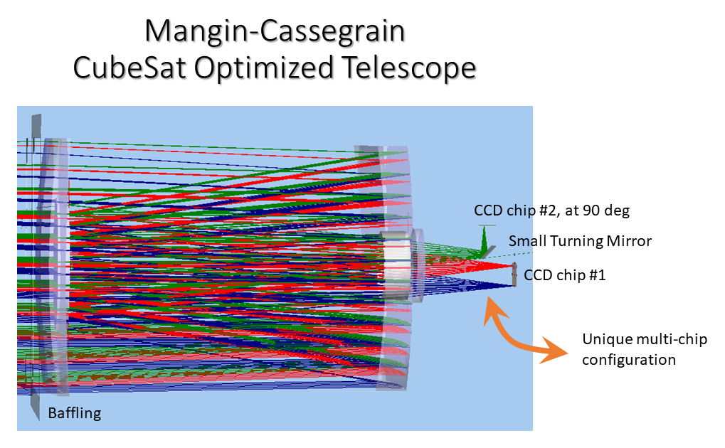
- Optional design with small turning mirror for 2 CCD chips
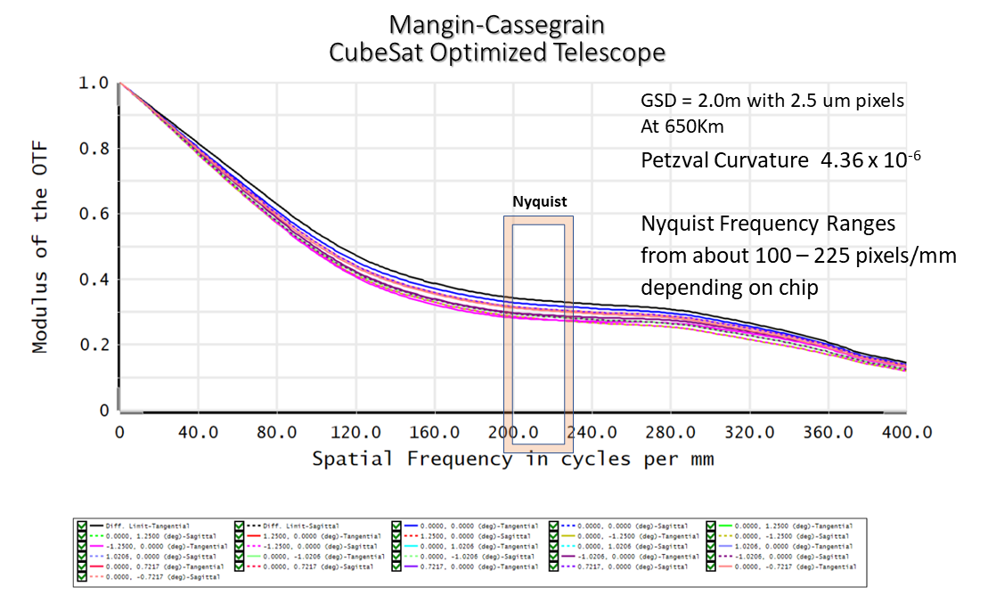
- MTF figure⟶
- Nyquist frequency ranges: about 100 - 225 pixels/mm (depending on CCD chip)
- GSD: 2.0 m with 2.5 um pixels at 650 km
- Petzval Curvature: 4.36 x 10⁻⁶
Applications
GOLD
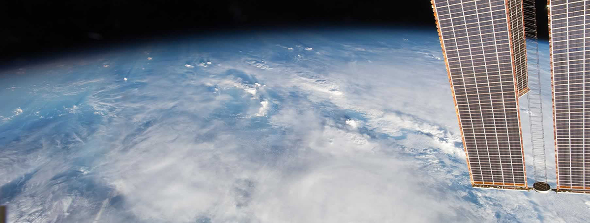
NASA’s Global-scale Observations of the Limb and Disk (GOLD) instrument onboard the SES-14 commercial communications satellite is the first mission to provide near-real time, continuous monitoring of the Earth’s ionosphere-thermosphere (I-T) on a global scale. It’s the space weather equivalent of civilian operational satellites that monitor terrestrial weather. CPI provides the algorithms, data processing architecture and operational software implementation for all GOLD Level 2 data products. CPI scientists have pioneered the algorithms and analysis techniques used to derive the GOLD data products through more than 25 years of previous experience with NASA, NOAA and DoD atmospheric remote sensing missions.
JPSS
CPI has a key role in the development of the Integrated Data Processing Segment (IDPS) of the Common Ground System used for satellite operation and data product processing for JPSS. Contributions include development of IDPS-specific software tools to streamline algorithm development and maintenance, and integration of the IDPS software configuration management between the science team, developers, and cal/val support contractors.